|
|

|
Main Menu |
Maungaharuru and Te Waka Ranges |
Photographs |
|
|
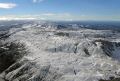
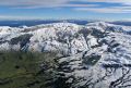
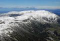
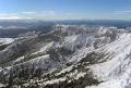
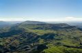
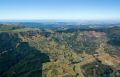
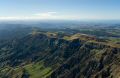
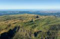
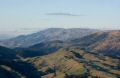
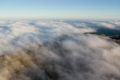
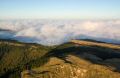
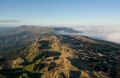
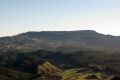
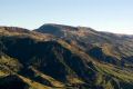
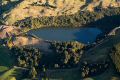
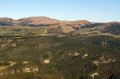
Maungaharuru and Te Waka together form the distinctive profile that dominates the horizon to the north of Napier and can be seen banner above. The highest point, Taraponui, is just short of 4,300 feet. Standing square to the prevailing westerlies with the Titiokura Saddle between the two ranges to accelerate the wind, and having the state highway and the national grid passing right by, the area is an attractive site for wind farming. The first resource consent applications were lodged about the time I took ownership of CST so decided I should photograph the turbine arrays areas while I had the chance. It's not the easiest of tasks: the wind that makes it good for power generation can make it hazardous for light aeroplanes and the job is still far from finished. A heavy snowfall on the range overnight on 17 June 2006 was followed by a dying southerly and clearing skies. The opportunity was not wasted and a lot of photographs resulted from the sortie on the 18th. However, one picture, number 12, has always stood out. Unfortunately the digital SLR was still six months away and both the film and digital compact pictures taken on this flight have their limitations (described on the technical page). There are some film-based images similar to the snow pictures here that would enlarge more easily than the jpeg-only digital shots, providing they are scanned by a professional laboratory.
|
|


|
Copyright (c) 2007 Peter Scott, all rights reserved |